Male’ Seawall Project (Maldives)
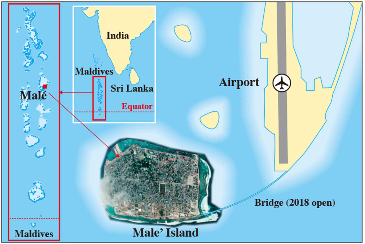
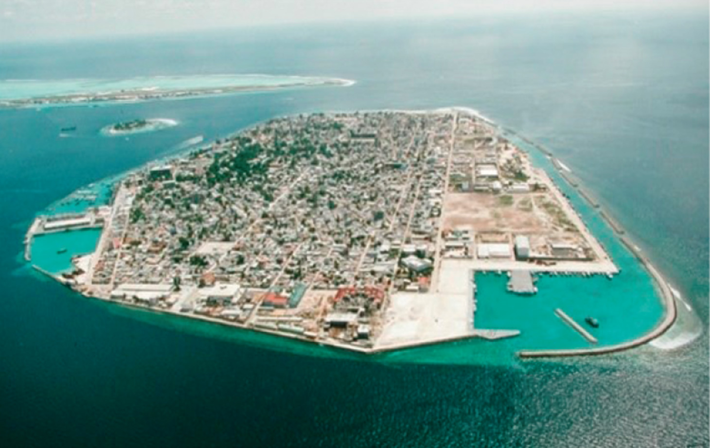
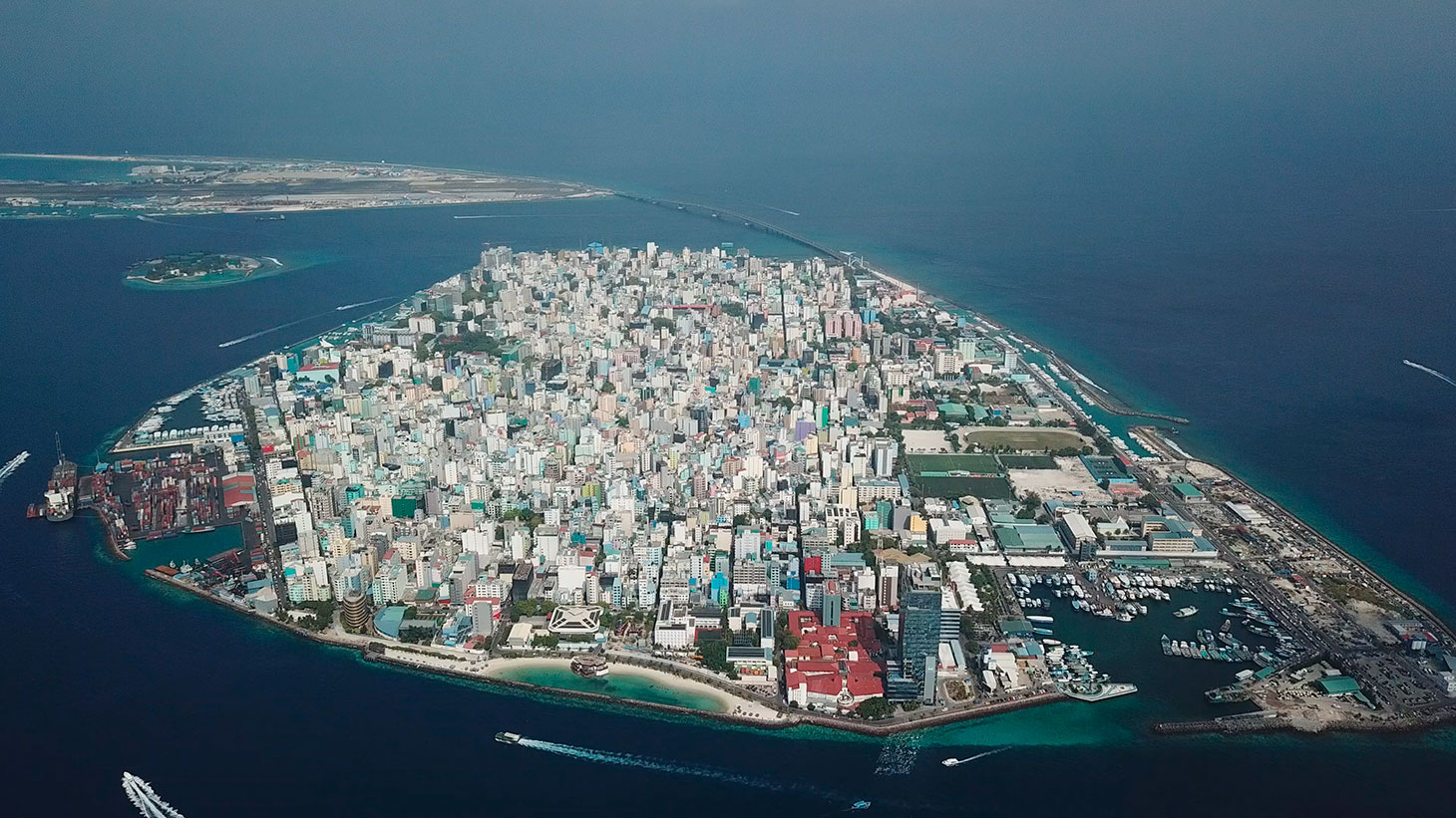
The Maldives consists of 1,190 islands and a chain of 26 atolls. The capital city of Male’ has a population of about 64,000, which is approximately 26% of the total population of the Maldives and the most densely populated capital in the world. Extraordinary high waves in 1987 hit the Maldives and the waves caused damage to property in excess of US$ 6.0 million. The southern detached breakwaters were constructed urgently by a Japan’s Grant Aid Project from 1987-1989. Then, from 1990-1992, a feasibility study on Seawall was prepared for the whole of the Male’ Island. Based on the recommendation of the study report, west, east, south, and north coast seawalls were constructed and funded by Japan’s ODA grant aid. The whole of the Seawall Project was completed in 2002. In the Maldives, all islands except for 9 were heavily hit by the Indian Ocean tsunami of 2004. One hundred and eight people died or went missing. Although two-thirds of the capital city Male’ was flooded, there were no reports of fatalities or injuries in Male’ because of the strong seawall that protected Male’ from the tsunami.
The Japan Society of Civil Engineers took up this project for the following reasons:
- 1)Strong seawall construction in Male’ protected Male’ from a serious disaster caused by the Indian Ocean tsunami. The President of Maldives briefed Ambassador Suda on the devastation caused by the tsunami. Noting that the breakwater and seawall around the capital, Male’ had protected the island from the worst effects of the tsunami, the president thanked the Japanese government for their important contribution in financing this important project.
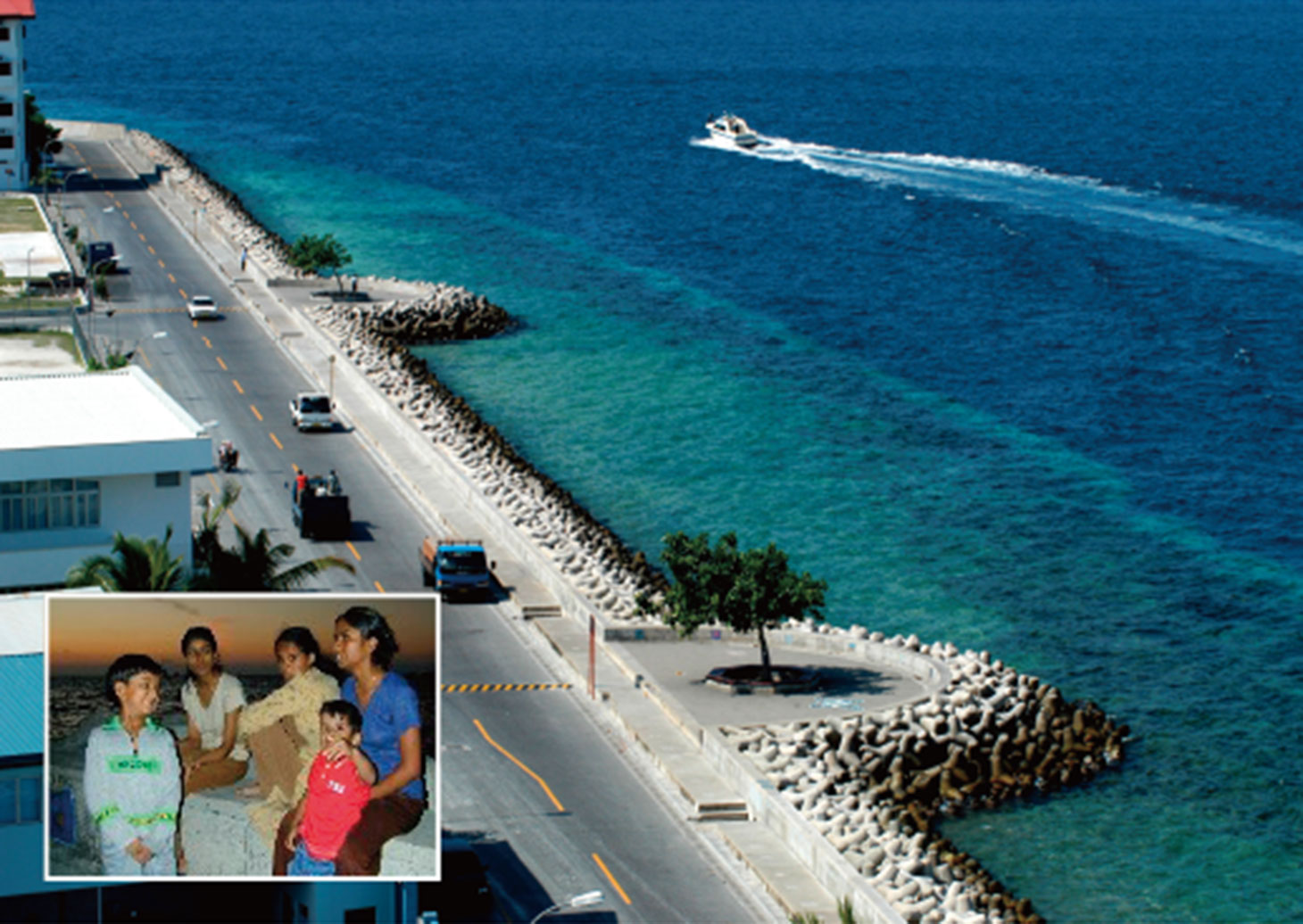
- 2)People living along the coastal area now have a safer way of life thanks to the strong seawalls of the Male’ island.
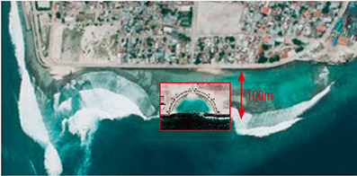
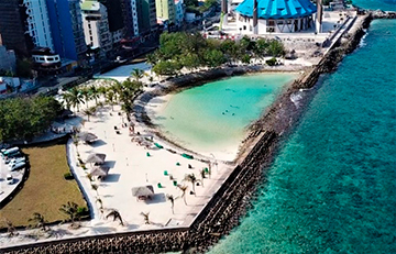
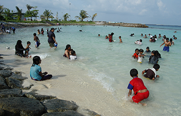
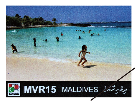
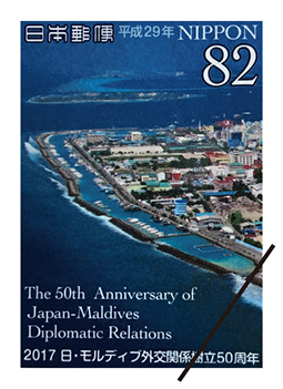
- 3)The creation of a unique artificial beach on the east coast provides a recreational place for the people of Male’ and was made into memorial post stamps.
- 4)The seawalls have been constructed in consideration of not only shore protection but also various functions such as seaside recreation, to aid the berthing of boats, and to act as a gateway for tourists.
1Project Background
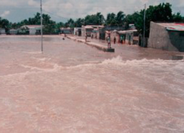
Any serious damage caused by extremely high waves may not have been recorded before 1986 in the Maldives, but from 1986 onward, high waves occurred three times and caused considerable damage in April 1987 and in June and September 1988. From April 10 to April 15,1987, extremely high waves occurred in Male’ (1.6 km long, 1.2 km wide, 1 to 3 meters above sea level) and its neighboring islands and caused damage to seawalls, private houses, airport facilities, etc. The total damage caused by these high waves was estimated to be about US$ 6 million concentrated along the heavily populated south coast area of Male’ Island and at the international airport on Hulhule Island. When high waves occur around Male’ Island, flood water remains for considerably long periods, mainly because the island is flat and low-lying and has no adequate drainage system. In 1987, due to a lengthy spell of flooding coupled with high temperatures, an epidemic of diarrhea broke out.
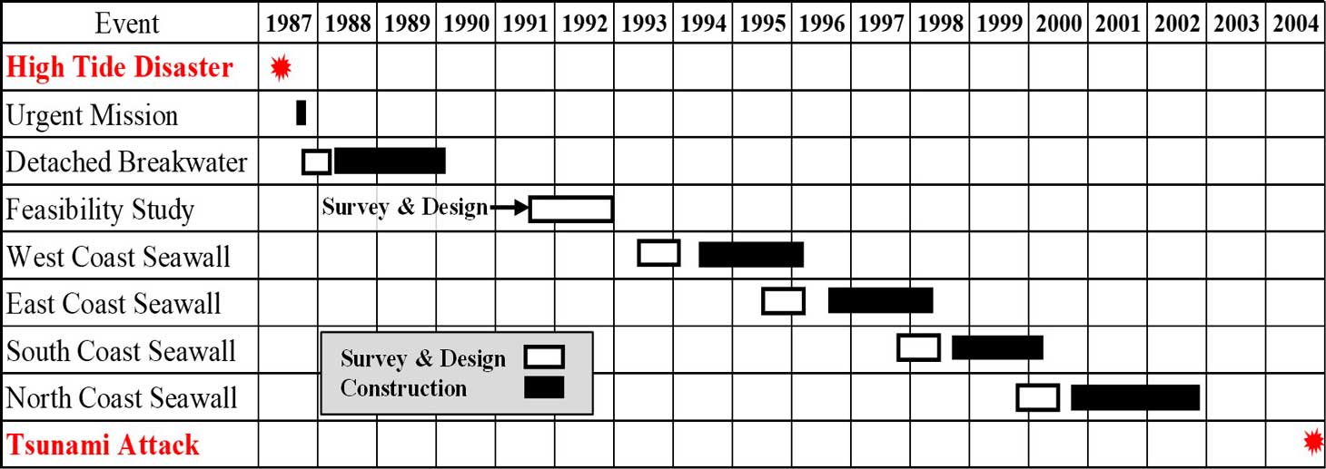
Immediately after the flood disaster in 1987, the Maldives requested the Japanese Government for an investigation into the damage caused by the extremely high waves. The Japanese government dispatched a team to urgently study the flood disaster for 9 days from April 24, 1987. The team surveyed the damaged sites and recommended an urgent construction plan of detached breakwaters in order to protect the southern coast of Male’ Island from the intrusion of big waves. Following this recommendation, the Maldives requested the government of Japan for grant aid to implement this project, and the Japan International Cooperation Agency (JICA) had a basic design study team to work in the field for 23 days from July 30, 1987. Based on the plan by JICA, the detached breakwaters were constructed and completed in 1990 along the south coast as an urgent means against extremely high tides.
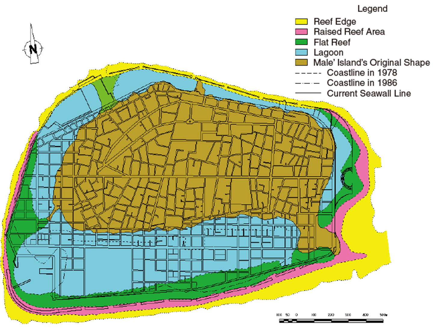
The whole coastal area was constantly washed by swells or waves and the roads behind the existing seawall became flooded due to the effect of water splashing over the seawalls. As the seawalls were not robust in their construction (being constructed of coral boulders 10 to 20 cm in size, capped with cement mortar), there are sections of the seawall that are misplaced/eroded, and therefore the waterfront is neither stable nor safe. In order to prevent such calamities, it is imperative that a permanent and secure seawall be constructed to keep the people of Male’ Island free from the ravages of Mother Nature and allow them to have a normal and safe living environment as well as maintain the social and economic base of the Maldives.
Considering these conditions, from 1990-1992 studies were made for the “Seawall Construction Project for Male’ Island”, and a feasibility study (FS) was prepared for the whole of the Male’ Island. Based on the result of the FS, seawalls on the west coast, east coast, south coast, and north coast were constructed according to the schedule given in the following section.
2Project Chronology
1. The development study on the Seawall Construction Project for Male’ Island in the Republic of Maldives (a feasibility study) was conducted from 1991 to 1992 by the JICA Study Team (a joint operation between INA and Pacific Consultants International (PCI)). This study consisted of a topographic/hydrographic survey, wave observation, current survey, environment survey, hydraulic model test, planning and preliminary design of the seawalls, and a project appraisal.
2. The basic design of the west coast seawall was conducted from 1993 to 1994 by the INA and PCI joint operation, and construction and its supervisory services were carried out from 1994 to 1996 by Taisei Corporation and the INA and PCI joint operation respectively.
3. The basic design of the east coast seawall including an artificial beach was conducted from 1995 to 1996 by PCI, and construction and its supervisory services were carried out from 1996 to 1998 by Taisei Corporation and PCI respectively.
4. The basic design of the south coast seawall was conducted from 1997 to 1998 by PCI, and construction and its supervisory services were carried out from 1998 to 2000 by Taisei Corporation and PCI respectively.
5. The basic design of the north coast seawall was conducted from 1999 to 2000 by PCI, and construction and its supervisory services were carried out from 2000 to 2002 by Taisei Corporation and PCI respectively.
6. The project cost for construction of the west, east, south, and north seawalls was financed by Japan’s grant aid scheme.
3Project Features
3.1Outline of the project
Based on the recommendations from the feasibility study, it was decided that the seawalls would be designed based on the waves, tide, and height of the seawall as below (Table 1).
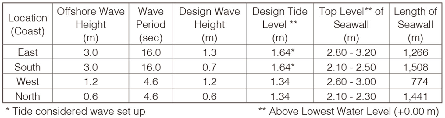
Typical sections of the entire seawall are illustrated below (Figure 1). The seawall structures consist mainly of mounds of rubble stone, tetrapods, and concrete blocks. Since the Maldives is a coral island, it was impossible to obtain construction materials such as stone, concrete aggregates, cement, etc. This is why all materials were imported from Indonesia by way of barges. Even freshwater for mixing concrete was produced using seawater from a desalination plant.
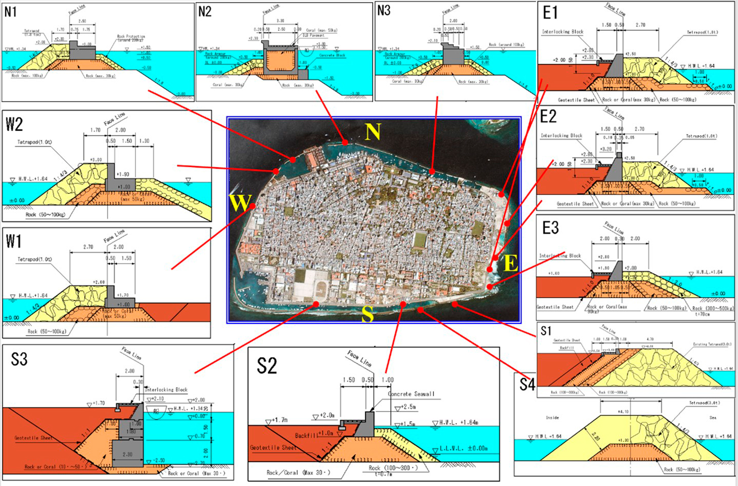
3.2West Coast
Since the west coast faces inside of the atoll, it suffered no big swell attacks, but wind waves (1.2 meters in height) generated in the atoll would hit the west coast in the monsoon season. The west coast is home to important facilities such as the island’s largest hospital, school, and social center, and so building the west coast seawall was the number one priority. There are two detached terraces and a 1.5 meter-long walking path for locals and tourists to enjoy stunning views of the beautiful sunset here.
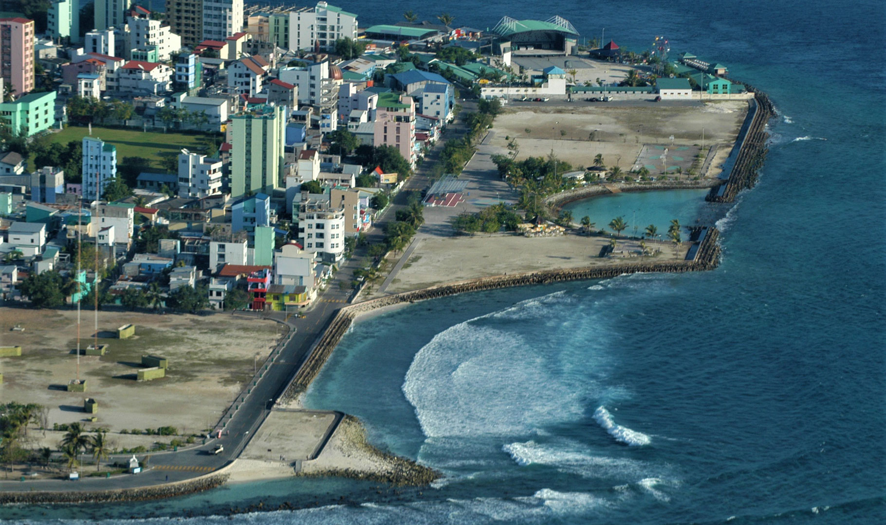
3.3East Coast
The Government of the Maldives planned to reclaim the shallow reef of the east coast in order to create a place of relaxation and to act as an area for recreation and sports facilities. Taking this into account, PCI proposed that the location of the new seawall along the reclaimed land be located 100 meters seaward from the existing coastline. The Consultant also proposed to create an artificial beach for the Male’ people to enjoy swimming safely at any time of day.
3.4South Coast
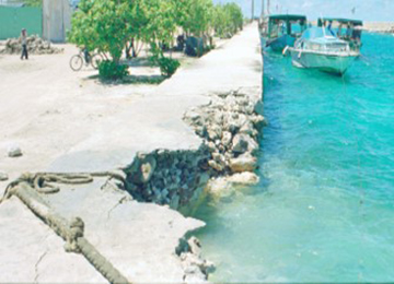
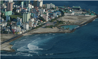
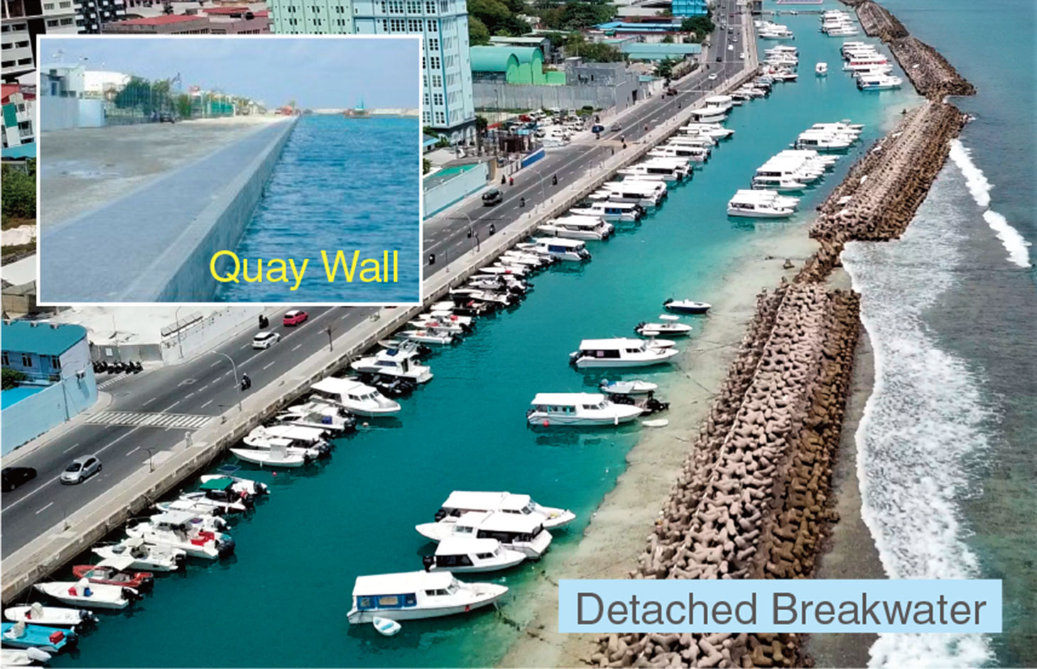
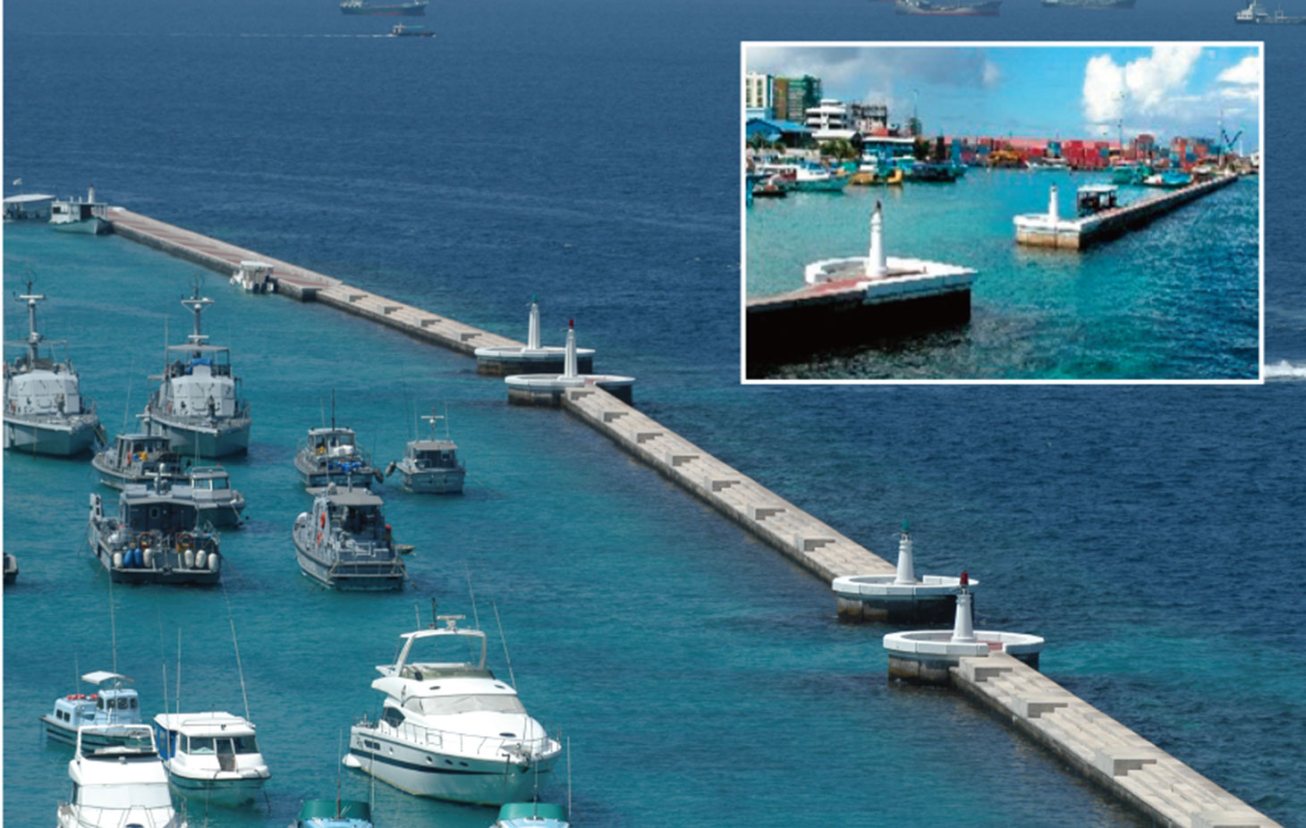
Big swells would constantly hit the south coast from the southern Indian Ocean. After the disaster in 1987, detached breakwaters were constructed in 1990. A calm water area behind the breakwaters was utilized as an anchoring space for pleasure boats or small boats voyaging between Male’ and remote islands. This project provided quay walls (water depth of 2.5 meters) as seawalls to enable said boats to moor safely. Now the quay walls are occupied by a lot of boats as shown in the attached photo.
3.5North Coast
The north coast is the most important and busiest place in Male’ because it is home to the president’s office, other ministries offices, banks, hotels, restaurants, airlines offices, coast guards base, a VIP jetty and ferry terminal connecting the airport and Hulhumale Island. Since the existing poor breakwaters were constructed of coral boulders, all the breakwaters were replaced by stone mounds and concrete blocks by this project. At each edge of the breakwaters, small beacons were installed as navigational aids for entering boats.
3.6The Tsunami in 2004
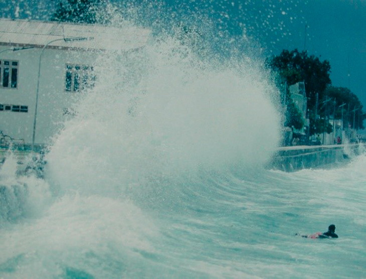
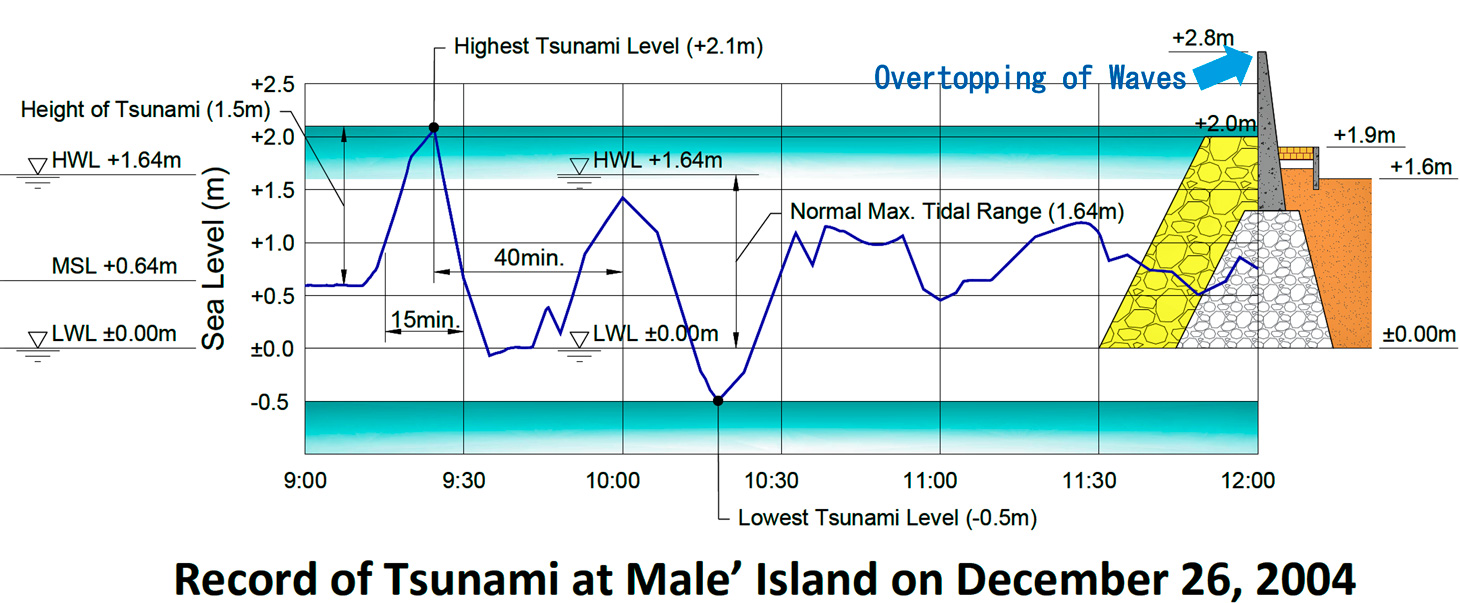
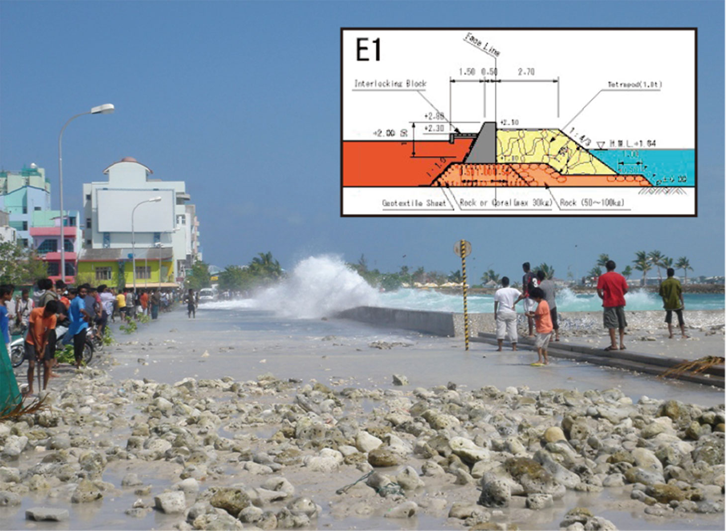
At 9:30 am on December 26, 2004, a huge tsunami attacked Male’ Island. The height of the tsunami was about 1.5 meters as shown in the attached figure. Since the tsunami occurred at the time of mean sea level, the top of the seawall was still about 60 cm higher than the height of the tsunami waves. At the time swells (about 1 to 1.5 meters in height) also hit the east coast as shown in the attached photo. Some waves overcame the seawalls and caused flooding on the island. However, fortunately, no serious disaster occurred on Male’ island due to the strong seawalls constructed with Japan’s ODA.
4Lessons Learned
1. It was very important to provide strong and maintenance-free seawalls in small low-lying islands in order to avoid a serious disaster due to high waves or a tsunami. The fact that the seawalls protected the people of Male’ from a huge tsunami disaster in 2004 proves the importance of constructing shore protection facilities.
2. Considering that concrete blocks (tetrapods) are useful to dissipate and mitigate the threat of high waves but interfere with locals and tourists enjoying themselves by the coast, PCI proposed an artificial beach on the east coast, which was the last possible area left to realize this idea. For the Government of Maldives to create an artificial beach as a part of the proposed seawall project, the corresponding portion of the seawall was planned with a gentle slope.
3. The coastal zone is one of the most important areas in the lives of the local people, so it was very important that the function of each coast be considered carefully when designing the seawalls. a) Two sets of terraces were additionally provided for people to enjoy views of the sunset on the west coast. b) On the east coast, not only an artificial beach but also a coastal promenade was set up for the people to enjoy jogging or walking along these scenic areas. c) In order to accommodate plenty of small passenger and cargo boats and pleasure boats safely, a quay wall (about 1,200 meters) with a water depth of 2.5 meters was constructed as seawall facilities on the south coast. d) Many tourists and VIP guests utilize the north coast as it is the only place accessible from the airport. To ensure calm conditions by protecting against waves from the north, 7 sets of detached breakwaters were constructed as part of the seawall project.
4. Although the seawall project is not such a big project, its impact was essential and very significant for the people of the Maldives. This is recognized by the fact that memorial post stamps were issued in both the Maldives and Japan.
Author
Sadao Orishimo
Born in 1948, Orishimo graduated from Tokyo Metropolitan University in 1972 and worked for Pacific Consultants International (PCI) from 1971 to 2008 and has been working at Oriental Consultants Global (OCG) since 2008.