Japan Society of Civil Engineers 1992 Study Tour –Travel Report-
Svante Roupé
Scandiacounsult International
(Recommended by the Swedish Society of Civil and Structural Engineers)
1. Introduction
In 1992 the Japan
Society of Civil Engineers decided to offer study tour grants to six different
countries,
to promote
exchange and dialogue between civil engineers. One of these grants was offered
to
the Swedish
Society of Civil and Structural Engineers, and I was given the honour of being chosen as
the very first
recipient.
Such a dialogue
is a very important way to enhance mutual understanding between colleagues in
different
cultures and
different parts of the world, and to learn from each others experiences and the
ways problems
are solved. It is
also much more interesting to get a view of culture projects and techniques by
means of
study visits to
the sites and discussions with the engineers involved, than by merely reading
about them in
international
branch magazines.
This travel report aims at giving the
reader a brief insight in a few of the large civil engineering projects
currently going
on in Japan, but also to inspire him to make connections and tie bonds between
notions
and cultures.
2. Study Tour
A study tour like this needs thorough
planning
a long time in advance. In this
process I got invaluable
help from the JSCE
in
arranging a suitable schedule. On an
early stage I was asked to
suggest projects
and institutions of interest
for study visits.
Being specialized in airport and
port design
myself,
with an emphasis on coastal
engineering, of course I was
interested to
study this kind of projects.
However I asked
for other
disciplines as well, and the study
tour schedule that JSCE
finally arranged for
me was a wide and
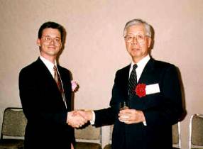
interesting spectre of Mr.Roupé
(left), Dr.Fujii (Presindet of JSCE,
Japanese skill
within the field of civil engineering. 1992-93)
The study tour
was performed during November
7 to November 18,
1992.
3. Civil Engineering Projects
3.1 Airport Projects
3.1.1 Kansai
Airport
A full day was
dedicated to Kansai new airport. I was received at Kansai International Airport
Co’s head
office in central
Osaka by Mr. Shinohara and Mr. Furukawa, who gave detailed and very interesting
background
information about the project.
The Osaka Bay
area today has a population of some 23 million people. Osaka is a busy
commercial centre,
and the existing
Osaka airport has 370 aircraft movements per day, a number that is increasing
all the time.
But its location
in densely built-up area results in that it has to be closed form 9 PM to 7 AM
due to
disturbing noise.
Congestion is already a big problem. There is no land available for further
expansion.
The bay shores
are surrounded by steep mountains, and all flat land is already developed.
The demands on a
site for an entirely new airport are; enough flat land for the airport itself and
its surrounding
activities,
approach directions free of obstacles, location isolated enough to allow
24-hour operation, but yet
easily
accessible. The answer was-in the bay!
Necessary land
for the new airport is crated by constructing a 511 hectares man-made island in
Osaka Bay.
This gigantic
land reclamation, made at a water depth of 18m, requires a total volume of 180
million cubic
metres fill
material. All this material is transported from pits shore to the island
location 5km offshore.
The sea bed
consists of a 20m stratum of sort alluvial clay, under that a sand layer and
then Pleistocene clay.
To accelerate the
consolidation of the upper clay layer the vertical drain method is used. To
drain the 20m
alluvial stratum,
sand piles with a diameter of 0.4m have been placed in a grid 2.5 by1.6m. The
total number
of such piles
amounts some1 million. The settlement of the alluvial and the underlying,
Pleistocene clay was
estimated to be
8m after 50 years. However, surveys conducted in1990 showed that the settlement
rate
was greater than
expected, and the total settlement was reestimated to 11m. This suddenly
created a demand
for further
17million cubic meteres of reclamation fill to keep the island airport at the
planned height above
sea level.
The airport will
have one 3500m runway, but plans have already been presented to expand the
island
for 2more
runways.
The huge terminal
building in steel and glass, to some extent inspired by Paris Charles de Gaulle
airport, is
designed by world
famous Italian architect Renzo Piano.
The island will be accessed by a3.75km bridge in two storeys with a dual 3-lane expressway on the top floor
and a dual railway below. There will also be a high speed ferry service to Kobe city centre.
After the
thorough briefing, Mr. Shinohara escorted us on a visit to the island by boat.
To understand
the huge
dimensions of this large scale project, it was almost necessary to see it all
on site. The coordination
of son many
contractors and different activities at one time was in itself fascinating to
watch.
3.1.2 Haneda
Airport Extension
Haneda Airport,
Tokyo’s domestic airport, is currently undergoing major extension works, which
all has to
be performed amid
busy air traffic.
An extensive land
reclamation is made, where 3 new runways will be constructed along with
taxi-ways,
aprons, terminal
complexes and new road and monorail facilities. The complex works are performed
by a
number of
contractors, one of which is Kajima. I was taken on an interesting full day tour
around the vast site.
All works have to
be made during full operation of the busy existing airport. The first of the
new runways is
already completed
and in use, alongside with the two old ones.
The seabed where
the land reclamation is made is a former waste disposal area, and soil
conditions are
extremely poor.
The sludge-like material which is referred to as the dredged in Tokyo Bay shows
the same
characteristics.
This is all consolidated in 6-12 months by means of vertical drains and an
enormous preload,
consisting of
several metres of extra fill material that will be excavated again when this
period of accelerated
consolidation is
over. Nevertheless, all apron slabs and building foundations have recesses for
jacks,
in order to
compensate for the settlement still expected to occur after completion of the
construction works.
The project also
includes a new road tunnel under a part of Tokyo Bay, to provide easier access
to the airport.
3.2 Port and
Townscape Projects
3.2.1 Kobe Port
Island
I was received at
the city hall of Kobe by Mr. Toyoda from the Port & Harbour Bureau. Mr. Toyoda
gave me
interesting information about the Port of Kobe, the large expansion projects
recently performed,
works in progress
and future plans.
The Port of Kobe
incorporates many different activities, including large shipyards, but the most
important
cargo handled is
containers. Kobe is one of the biggest container ports in world, with an annual
throughput
of 2.5 million
TEU. To provide the necessary stacking areas as well as easily accessible
berths, a man-made
island with an
area of 436 hectares was created, known as Kobe Port Island. The reclamation
works
were completed in
1981. About half of the island belongs to the Port of Kobe, while the
remaining,
central part
belongs to the City of Kobe, and is used for residential areas, large hotels
and other activities.
The island is
accessed via a bridge that, except for the car lanes, also leads the Portliner
railway to the island.
This is an
automatic, computer controlled railway running on overhead tracks, with a
capacity of 10000
passengers per
hour.
A second island
of reclaimed land, Rokko Island, has recently been completed. This island
measuring 580
hectares, is also
shared between urban functions in the central parts and port activities in the
peripheral
areas. Works are
in progress with Kobe Port Island stage 2, an extension that will add 390
hectares
at the southern
end of the existing island by the year 1996. As this will generate increased
volumes
of road traffic,
a new road tunnel will be constructed to the mainland, and another one to Rokko
Island.
Plans have
already been presented for development of a new airport on yet another man-made
island
outside Kobe Port
Island.
In order to build
the artificial island, earth and sand has been excavated from the mountains
behind the city.
To move the earth
from the mountainside to the sea, an integrated system was created to increase
efficiency of the
engineering works and to minimize the environmental impact on the city. A large
conveyor belt
transports the material through a mountain tunnel, thereafter the belt
continues elevated
and covered
through built-up area to an automatic loading pier for hopper barges. The
excavated area,
in turn, are used
for new residential and industrial estates.
After a
presentation Mr. Toyoda took us on an interesting tour around Port Island, and
showed
the ongoing
reclamation and soil improvement works for the second stage.
3.2.2 Minato
Mirai 21
The seafront of
Yokohama is currently undergoing major changes, giving the city a new face
towards
the Tokyo Bay. I
was received at Yokohama’s Municipal Office by Mr. Okazawa and Mr. Seki,
who presented the
Minato Mirai 21 Project. This is an enormous urban development project,
changing
the function of a
vast area in the central part of the existing city.
Yokohama is
Japan’s second largest city, with a population of approximately 3.25 million
people
and is since long
one of the world’s biggest ports. There are 91 berths operated by City of
Yokohama,
and in addition to that a great number of privately owned and operated berths.
Minato Mirai 21,
that is the main part of “Yokohama 21st Century Plan”, has two
objectives:
(1) to concentrate
into one area Yokohama’s city centre which is presently divides betwee
the area around
Yokohama Station and the Kannai district, and (2) to create new functions
like a seafront park and recreation area, large convention facilities, hotels, cultural activities etc,
as well as new arterial roads.
186 hectares of
land has been allocated for this purpose, of which 110 hectares are existing
land
from the inner harbour area. This was formerly a port zone, also with heavy industrial
activities like
shipyards etc. All
of these factories were rather old and deteriorated and have now moved to new
and more
functional areas in outer parts of the port. The land obtained by clearing
these areas was
enlarged by
reclamation of further 7 hectares of land. On this area the town planners and
architects
have had the
challenging task to create a functional environment for conventions, business,
commercial
and cultural
functions as well as recreation. It is a project carefully prepared in all
scales, from the
smallest details
to monumental buildings like the new, high-rise Landmark Tower with 70 storeys.
The seafront
pedestrian area, situated in the heart of a busy port, has an existing view.
Minato Mirai 21
aims at being renowned over the world as the ideal spot for international
conventions and
exhibitions,
easily accessible and with facilities to meet all needs.
After the
presentation, we were taken on a boat tour around the port, looked at all
berths and stacking
areas and passed
under the impressive Bay Bridge, a 860m long cable stayed bridge. Finally we
disembarked at Pukarisanbashi Pier and
walked along the shoreline promenade, through the Rinkoh Park
to the Exhibition
Hall at the Pacific Convention Plaza.
An interesting
glimpse of the 21st Century.
3.3 Bridge and Road
Tunnel Projects
3.3.1 Akashi
Kaikyo Bridge
The Akashi Kaikyo
Bridge will be one of three connections between Honshu and Shikoku islands two
of the
four main islands
in Japan. The bridge is going to be the longest suspension bridge in the world,
with a total
length of 3910 m
and a centre span of 1990 m.
I was greeted at
the site office by Mr. Kawaguchi, who told me about the planning of the project
and the
engineering problems encountered during the design phase. After that, I was
taken out
by boat to the
Akashi Straits, a busy fairway utilized by about 1400 ships per day, to have a
closer
look at the works
in progress on the caissons and towers.
The clearance at
the centre of the bridge will be 65m. The two towers will be 297m high, founded
on steel
caissons. These were prefabricated ashore, towed in place and sunk in a water
depth of
approx 40-45m.
One problem was to avoid undermining of the foundations by scouring, as very
strong tidal
currents occur in the straits. The caissons are set on filter beds of graded
stone material,
designed for a
current velocity of 4.5m/s. The bridge structure is designed for an average
wind velocity
of 46m/s during
10 minutes, with a peak of 80m/s. and for an earthquake of 8.5 on the Richter
scale.
These conditions
have a statistical return period of 150 years.
The bridge will
have 2x3 lanes, and be a part of a new highway system, stretching from Honshu,
the largest
of the Japanese
islands, via the relatively small Awaji Island to Shikoku.
3.3.2 Trans Tokyo
Bay Highway
The Trans-Tokyo
Bay Highway Project will result in a 15km toll highway that runs across the
central portion
of Tokyo Bay from
east to west in connecting Kawasaki district on the Tokyo side and Kisarazu
on the opposite
side of the bay. Two 10km long tunnels will lead under the Kawasaki waters
where surface
traffic is heavy, and 1 5km long bridge over Chiba waters where surface traffic
is sparse.
There will be two
man-made islands along the stretch, one at the middle of the tunnel, and one
where
the traffic is
led from the tunnel up to the bridge. The tunnels will be made using shield
tunnelling technique,
with an outer
diameter of 13.9m for each tunnel.
At the centre of
the tunnel is Kawasaki Man-Made Island. This circular, 193m diameter island is
being constructed
for the purpose of providing a base for the shield tunnelling works during
construction,
and to serve as a
ventilation shaft for the traffic after completion. The water depth is 28m, and
to a depth
of more than 30 m
under the seabed the soil is very soft.
The Kisarazu
Man-Made Island is constructed to create a slope on which the tunnels will rise
from the bay
bottom to the
bridge embankment. The 5km bridge will consist of steel piers on steel piles,
supporting a
superstructure of
steel box girders with orthotropic decks. It will be 40.85m high at the centre
spans of the
deep water area,
where the fairway will cross under the bridge.
I was taken out
tour the site by boat. First we saw the works at the Kawasaki side then we
visited the
Kawasaki Man-Made
Island, to see the ongoing construction works. After this stop we went past the
Kisarazu Man-Made Island and the works
on the bridge piers.
3.4 Tunnelling
and Rock Cavern Projects
3.4.1 Loop 7
Underground River
Due to urbanization
and paving of most areas in Tokyo, flooding of the existing rivers during heavy
rainfall
has become a
frequently occurring problem. To widen the existing rivers is difficult because
of the problems
to obtain the
adjacent land. Therefore Tokyo Metropolitan Government has decided to develop
an
“underground
river system”. Underground rivers are constructed under arterial roads,
combined with
regulation ponds,
to help accommodate the water during a peak flow situation.
The total length
of Loop 7 Underground River will be 30km. It will draw water from ten different
rivers on
its way down to
Tokyo Bay, where the water will be discharged by pumps. The first portion of
the project, Loop
7 Underground Regulation Pond, is an excavated tunnel, about 2km long and
constructed
by a joint
Venture with Kajima as one of the partners. The pond is made by using shield
tunnelling
technique. For
this purpose a shield tunnelling machine with an outer diameter of 13.94m, the
biggest such
machine in the
world, has been developed.
When I visited
the site, the excavation works of the tunnel itself had only just begun. From
the 28 m
Diameter
launching shaft, some 50m had been driven through the gravel and silt layers at
a depth
of 50m below
ground level. The average tunnelling capacity will be 5m/day during full
operation,
which will
generate 700 cubic metres of excavated material per day. Although not very long
yet,
it gave the full impression of the huge machine and the automatically set and anchored, pre-fabricated
concrete shields.
3.4.2 Sabigawa
Dam Project
The Sabigawa Dam
Project is situated close to the town of Nasu-Shiobara, about 130km north of
Tokyo. This is an area famous for its scenic landscape.
I was met by
Kajima’s site manager, who first took me to the site office, where I was shown
a video and
was given some
further information about the project. Thereafter we went to see the site,
beautifully
situated within
the Nikko National Park. Because of the location, special care has been taken
during all
phase of
construction to preserve the environment.
The project
consists of the construction of a pumped storage power station. The principle
is to lead water
from an upper
reservoir through turbines to a lower dam in the daytime, i.e. more or less an
ordinary hydro
power plant.
During night however, when electric power is less expensive, the water is
pumped back the
reverse
direction, to the upper dam. The next day the same water is used again to
generate power when
the demand is
high.
The upper dam is
a rockfill dam with an asphalt concrete facing. It is 90.5m high, making it the
highest dam
of its type in
the world. The lower dam is a concrete gravity dam with a height of 104m.
From the upper
dam with a gross storage capacity of 11900000 cubic metres, tunnels with a
total length
of 2.3km are
drilled through the mountain, to form headrace, penstock and tailrace, leading
down to the
lower dam.
Effective water head is 338m. The largest tunnel is the headrace, with a
diameter of 8m.
The powerhouse is
also situated in a rock cavern, about 300m below the mountain surface. This
cavern
is 29m wide, 51m
high and 165m long, housing three generator units, each 300MW. The total
excavated
volume of rock
from tunnels and powerhouse is 238570 cubic metres.
3.5 Research
Institutes
3.5.1 Kajima
Technical Research Institute
Kajima
Corporation have their own large research facilities in Tokyo, the Kajima
Technical Research
Institute. This
Institute has amazing resources to perform research in a wide field of
disciplines. I was
shown several
different laboratories, e.g. the hydraulic laboratory that among many
facilities has a large wave
basin with a
computer-controlled, serpent type wave generator able to create all kinds of
irregular waves
by superposition.
I also visited the laboratory for soil mechanics, where a huge geotechnical
centrifuge was
demonstrated.
Another
impressing visit at the institute was the earthquake research department, with
its
computer-controlled
shaking table. 5x5 m, it is capable of producing a 2 G acceleration in both
horizontal
and vertical
direction, loaded with a 30ton test specimen. This way it is possible to
simulate earthquake
forces on very
large models as well as full scale tests on individual building members. One
result of this
research is a
proposed high-rise building, where the stiffness of the steel-frame structure
is continuously
variable by a
computer. When this building is rocked by seismic forces, the swaying of the
structure
can be damped
out. I also saw acoustic laboratory with its Anechoic chamber and many other
facilities.
In elegant
exhibition halls many results of the research were shown, such as light-weight
carbon fibre
reinforcement for
concrete, proposed floating residential complexes, floating waste incineration
plants, etc,
etc. Indeed a
creative environment!
3.5.2 The Port
and Harbour Research Institute of Yokosuka
The Port and
Harbour Research Institute of Yokosuka is situated some 50 km from central
Tokyo,
close to the mouth
of Tokyo Bay. I was received by Dr. Katoh, who is head of the littoral drift
division
and laboratory at
the institute.
This institute
performs research within all fields of engineering related to marine
structures. After having
been welcomed by
Mr. Watanabe, Director General of the institute, I was guided around the
different
divisions, where
I was given brief introductions to the current research projects.
First I was shown
AQUAROBOT, a robot for various underwater tasks, developed at the institute.
This is a remote
controlled, six-leg concept allows it to operate on very rough surfaces like
e.g. a collapsed
rubble mound
breakwater, where wheel or caterpillar type robots have difficulties to move.
Then I was shown
a large laboratory hall for large scale loading experiments, with two 15 m long
reaction
walls at right
angles, and a reaction floor. The walls and floor are designed for 1MN of shear
stress
and 2MN bending
moment per unit width. The laboratory has actuators with a maximum force of
up to 1.5MN, to
carry out statical as well as dynamic tests on large specimens. This is used
e.g.
for fatigue tests
on caisson walls. Next stop was hydraulic laboratory with its large, computer
controlled,
submergible
shaking table. With this equipment it is possible to perform large scale tests
of the impact
of earthquake
forces on marine structures. This laboratory also possesses a large basin for
current trials.
At the time of
our visit model tests were carried out on rubble mound structure exposed to forces
from
a Tsunami induced
current, that may reach 8m/s.
In the same hall
is a wave basin with a serpent type, computer controlled wave generator, able
to simulate
all kinds of
irregular wave patterns. We also visited the soil mechanics laboratory, where I
among other
things saw a
large geotechnical centrifuge.
Dr, Katoh told me
about the Hazaki Oceanographically Research Facility (HORF), operated by the
littoral
drift division.
This is a research pier, a 427m long concrete structure on steel piles and
columns, stretching
perpendicularly
from a sandy beach.
By using this
facility it is possible to follow and record a sea wave breaking, propagating
through the surf
zone and rushing
up on the beach. Changes in bottom topography, caused by different wave climate
conditions are
also continuously registered. Sampling this kind of data, alongside with
meteorological
recordings and
analyzes of sediment size distribution, is of great value in the research to
understand
the mechanisms of
littoral drift and predict the evolution of a sandy coast.
Unfortunately
these premises are located to far away to visit in the same day, but I was
shown interesting
photographs and
results of measurements carried out there.
4. Conclusions
Comparing civil
engineering in Sweden and Japan shows many differences but also many
similarities. One
difference is the
scale of the projects. Japan today is in a way what the United States used to
be; many
projects are in
one respect or the other “biggest in the world”. This is to a large extent
conditioned by the
population
density. Virgin soil is a limited resource, and land prices are sometimes
enormous. This can
make technical
solutions that would never be financially justifiable in Sweden the best
solution in Japan.
What may be
absolutely necessary for Tokyo with some 12 million inhabitants, is maybe not
even
interesting in
Sweden and Denmark, to promote business and communication within Europe.
Earthquake forces
is something we do not have to consider at all in Sweden, with the stable
geological
conditions
prevailing in the Scandinavian mountain ridge. Rock mechanics is a field where
Swedish
engineers since
long have a reputation of being on the frontline, and there are at present
several joint
venture projects
between Swedish and Japanese companies related to e.g. rock tanks for oil and
storage
of nuclear waste
in rock caverns.
In the field of
environmental engineering both Japan and Sweden have come very far. However,
since it is still
a young science, exchange of experiences can bring it much further.
Regarding
industrial welfare and security on construction sites, both countries have a
conscious attitude.
When it comes to
standard of housing and conditions in offices. Sweden still is the leading
country.
One thing that is
striking about Japan is the large investments in research and the impressive
facilities
available, in
governmental institutes as well as in research departments within the leading
construction
companies.
Finally I would like to thank the Japan Society of Civil Engineers for giving
me this fantastic
chance to visit
Japan. It was an unique and most valuable opportunity, not only to get a closer
view
of Japanese
know-how in the field of civil engineering and have fruitful discussions with
skilled colleagues,
but also to see
the beautiful country and learn more about the rich culture and traditions of
Japan.